The Shape of the River
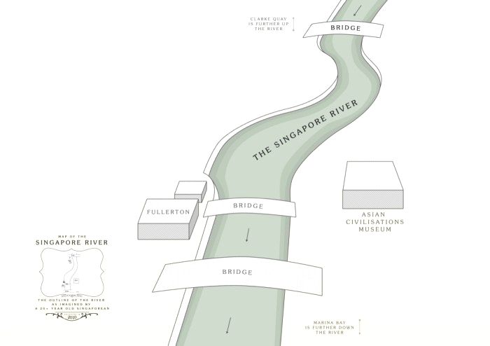
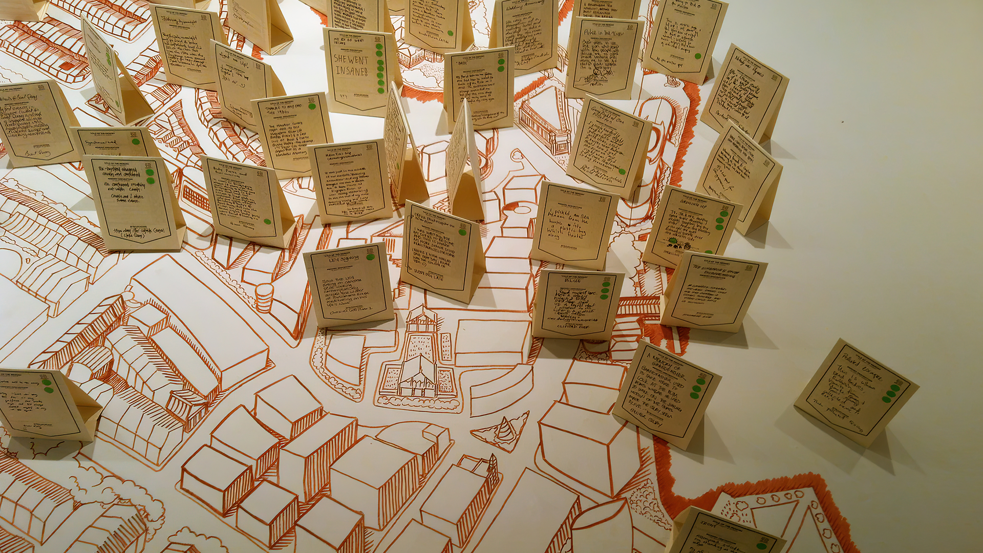
What does the Singapore River look like? When prompted to reflect on the river, many find it hard to recall the geography of Singapore's most significant river – which has changed drastically in purpose, form, and colour over the last hundred years. Sitting by the river, I began surveying people around me on what they thought the river looked like...
Thee main difference between hand-drawn maps and commercially available street directories or maps is that hand-drawn maps selectively omit extra information that is not directly on the route taken, where as commercially produced maps often present data to a great degree of precision and painstaking detail. This detail may prove essential in some cases where one wants to locate very specific details on a map, but in most cases, the amount of detail may be more than the traveller will actually require for navigating a particular route/journey.
For the purpose of each singular journey, the extra information not relevant to one’s journey is only visual clutter which is more confusing than actually useful. By sketching one’s own maps, one produces a map that reflects only the most essential information required for navigation along one particular route, omitting all other excess detail that is not essential for the successful navigation to one’s destination. However, scale and precision does suffer in the hand-drawn map – a kind of purposeful simplification of data. Angles at which roads intersect may be misrepresented or simplified into straight roads or curved roads, and lengths of roads are unlikely to be depicted to scale but are more likely to be drawn relative to each other. There will always be some “topological invariance” (Lynch, Image of the City).
Certeau writes: “In walking it selects and fragments the space traversed; it skips over links and whole parts that it omits. From this point of view, every walk constantly leaps, or skips like a child, hopping on one foot. It practices the ellipsis of conjunctive loci . . .
As such, gaps are deliberately created in the “pedestrian rhetoric” of hand-drawn maps. This “pedestrian rhetoric is the pedestrian’s logic that the only parts of the city which exist or are worth recording on one’s map are the areas accessible to the pedestrian, which results in the omission of whole sections of the city which are not visible to the pedestrian on his route through the city.
2010
Series of 10 Digital Prints
The Substation, 2010.
Art Agenda, 2023.
The proposal for this work won The Substation's Visual Arts Open Call and the work was presented with the support of The Substation.