Recently, I read, with some incredulity, that the Singapore River was to be diverted for the digging of new MRT tunnels (Downtown Line).
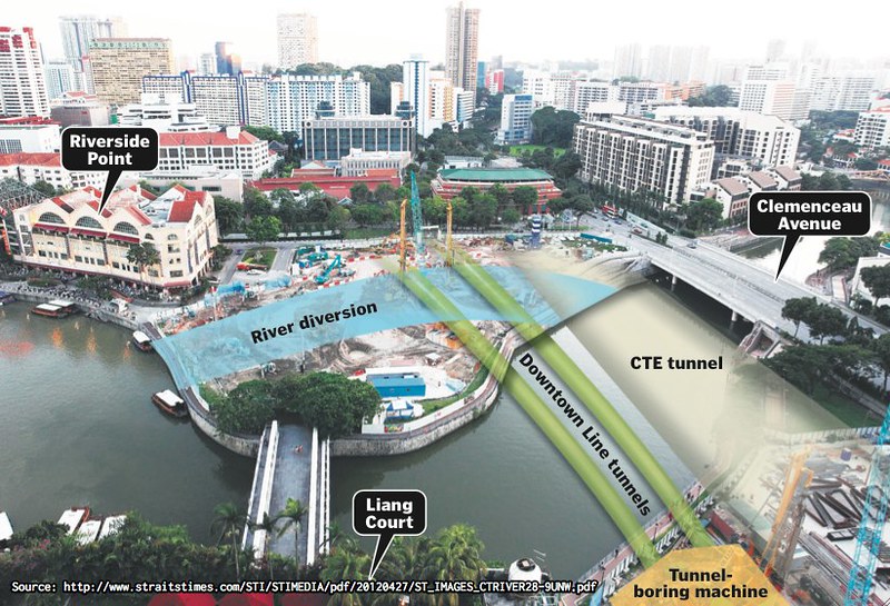
ST Breaking News (28 April 2012) – Singapore River diversion a herculean task:
“The plan to divert the Singapore River may be the most ambitious part of the MRT Downtown Line project. The herculean task, to begin by the end of the third quarter, will reroute part of the river next to Riverside Point into a bow-shaped canal. (…) The river is being moved so that the Land Transport Authority (LTA) can bore two train tunnels under it for the Downtown Line 3.”
ST Breaking News (28 April 2012) – Singapore River to be diverted for MRT tunnels:
“Part of the Singapore River, the site of Singapore’s earliest settlements, will be moved so that an MRT line can be built under it. In the first undertaking of its kind, the Land Transport Authority (LTA) and Korean builder GS Engineering & Construction will dig a bow-shaped canal to divert the river. It will then clear the drained portion of age-old debris and fill it with a stabilising material before boring two train tunnels under it. The original path of the waterway will be reinstated after the tunnels are completed.”
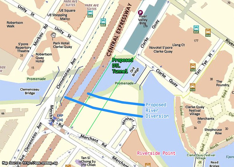
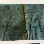
Map Source: OneMap. Annotation by Debbie.
The fate of excavated debris and soil is something I have puzzled over for some time now. What will happen to all this “age-old debris” after they dig it up? Do they use it to fill up other spaces? Do they bury it somewhere else? Do they give the soil to others to reuse in other landfills? What happens to the soil from (commercial) excavations?
It has been known that sometimes the government does allow a pause in these redevelopment/construction works to allow for archaeological digs. This has happened for a number of old sites around the central part of Singapore, such as the Old Parliament at Empress Place, the National Art Gallery (a very short spell though). But crucially, because this has not yet actually happened, there is still a possibility for a proper request for an study of the dig site at the Singapore River before it too has been built over forever.
Back in April, I made some notes about John Miksic’s lecture on “Guerrilla Archaeologists and the Singapore Story” here on my other Documentations blog. When he spoke about the importance of archaeology particularly in areas which were endangered and about to be dug up, I also immediately thought of the Downtown Line excavations which are all in the town area. I’m interested in the DTL excavations around Sungei Road. But of course, now it appears, the Singapore River itself is also at stake.
What is the importance of doing an archaeological dig? Why is it important to study the Singapore River then? Well, I think one thing that is often eclipsed in accounts of “Singapore History” is the presence of a history before Raffles. These archaelogical studies, as well as the acquisition of the Beilitung Shipwreck (however much the ethics might be dispute) are reminders that Singapore is not only in existence because of its colonial history, but it has a much longer history as a place in this region.
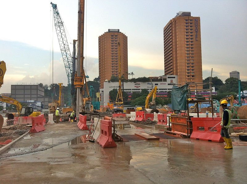
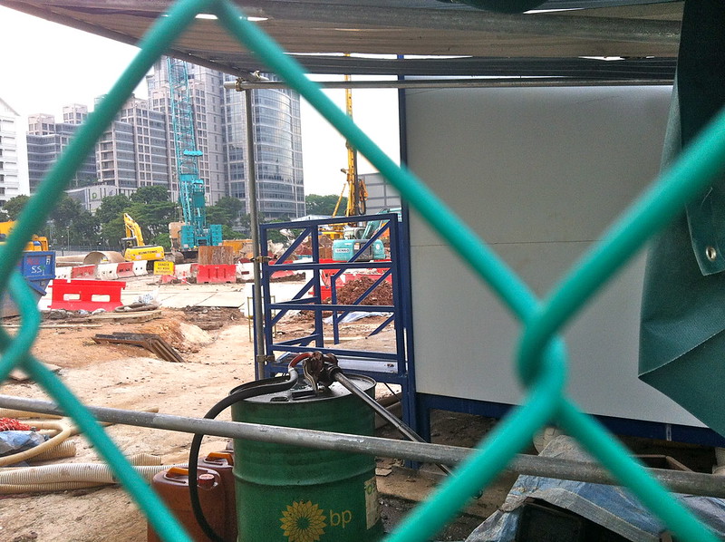
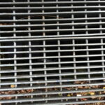
Photo taken on 4th May – Around the River Valley Station Construction Site
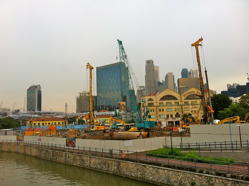
Photo taken on 4th May – Piling works have already started as evidenced by photos taken around the site.
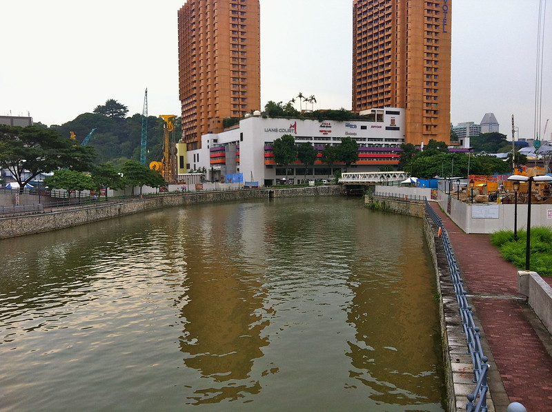
The part of the waterway that they are planning to divert.
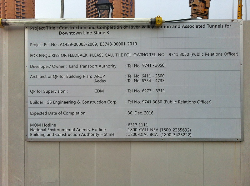
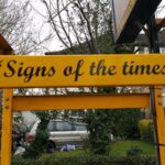
This signboard has the list and phone numbers of all the agencies involved.
I suppose the first thing to do is to raise awareness of the value of an archaeological study in that area. Someone has already set up a facebook group here for starters – Singapore River diversion – Protect Our Heritage where they are asking for 6 months to allow the NUS team to study the site. Will this be acceded to? Perhaps we need more public support to persuade the authorities to allow this break in construction for an archaeological study. But after all, what is six months to study a historical site that might never be accessible again for all eternity?
It looks like I might have to update my animation of the changes in the Singapore River…. although by the way things are going, maybe I should have to wait to see if other parts of the Singapore River also gets moved about. It’s already been shown that here in Singapore there are no sacred cows: there are no monuments, no heritage sites, no geographical features, and no buildings here that cannot be wilfully moved or destroyed. But this is an attitude that needs to change – or at least for people to be more educated about what will be lost from all this, and what we could have gained from it as well…
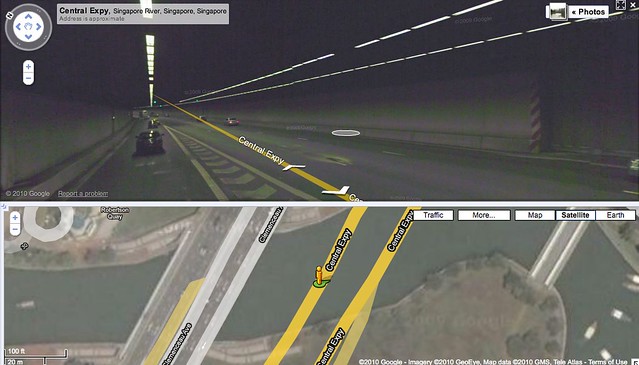
Another view of the River (from a screenshot I took in August 2010):
Related posts:
 Artist who makes artworks about Singapore River finally takes boat ride on Singapore River
 The Chert of Pulau Saigon, a former island in the Singapore River
 A walk along Stamford Canal
 Bone, Metal, Wood, and Other Artefacts found on Pulau Saigon
 The World’s First Cash Machine and New River Swans: A walk through Enfield Town, World’s End and Cockfosters
 “Theo.do.lites” (Institute of Contemporary Art Singapore Gallery 1, 17 April – 20 May 2013)
 The Mineral collection at the Natural History Museum, and Flint Nodules along the River Thames
 The Collectors of Pulau Saigon: Murex Trapa shells, and Pyrites (Fool’s Gold)