This continues from the previous post, where the iPhone GPS data has been batch exported to Excel BUT in a weird DMS format rather than the DD format that we need in order to import into TileMill. Unfortunately, there is no magic button or plugin for this, but in the end… it turns out… its not that hard after all. Doh.
=SUM([@[D-Lat]]+[@[M-Lat]]/60+[@[S-Lat]]/3600)
=SUM([@[D-Lon]]+[@[M-Lon]]/60+[@[S-Lon]]/3600)
Note that iPhone’s format may actually be D,M(in decimals) without an S value.
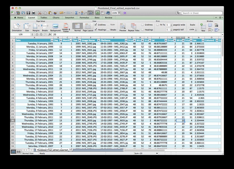
(See Lat and Lon column. TileMill will understand any of the following column headers: latitude, longitude, lat, long,lon, x, y.)
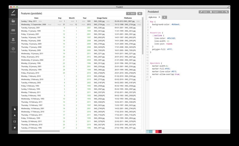
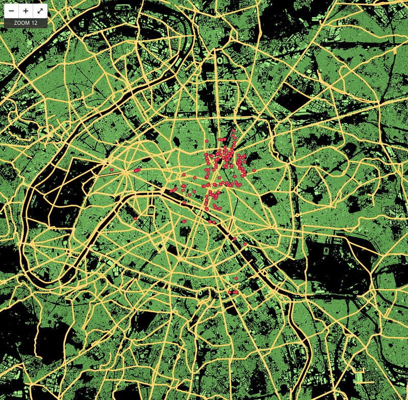
Data successfully imported into TileMill Layer!
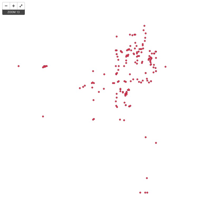
Plotted successfully! But what is this? IT IS ALL EMPTY!?????
Oh so I forgot to add in any shape layers. So next we need an ESRI Shapefile for city of Paris available here here and here from metro.teczno.com and downloads.cloudmade.com respectively, based on OpenStreetMap data. [See also: Adding Layers in TileMill]
Some random slapbang colours here just for testing purposes.
SUCCESS!!!
Now I will finetune it from here…
Related posts:
 Geocoding: From the streets to Adobe Bridge and then Excel (Part I)
 Tilemill – Conditional Label Placement, Pseudo 3D Building Effects, and Polygon Patterns
 Field Recording: “Hava Nagila” (27 September 2012, Paris)
 Field Recording: French Rap and Derbouka on Paris Metro (12 October 2012, Paris)
 iSeismograph on the MRT
 Lessons in 3D Printing: Raft Vs Brim Vs Skirt
 Field Recording: Paris Gypsy Band on the Metro, 11 September 2012
 UP Singapore Urban Prototyping Weekend – Postcode Postcard